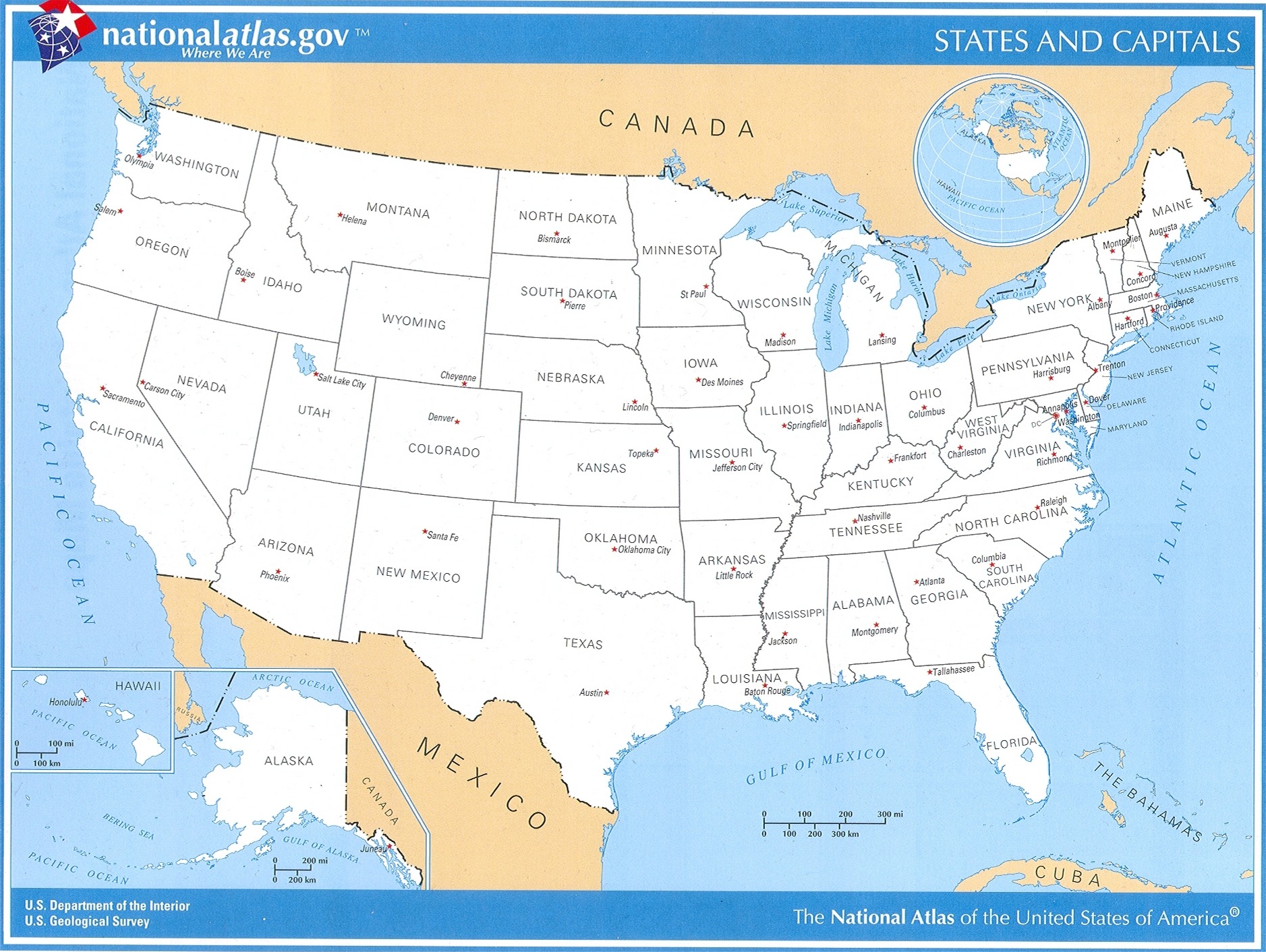
United States Map with Capital Cities
Enter your search query in the box below.
Home Page > United States Maps > United States Map with Capital Cities
United States Map with Capital Cities
Below you will find a large map of the United States showing all States and their capital cities. This is a large image file. Our website format reduces the display size for uniformity.
Here is a link to the full-size image that is more easily readable.

From the National Atlas of the United States
United States Department of the Interior.
State Maps
Territory: Puerto Rico
County Maps


